The
Black & White
Picture
Place
Old Maps and Aerial Photographs of Chester
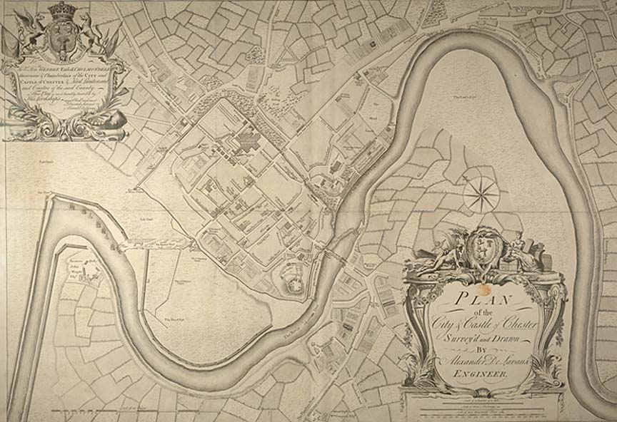
Lavaux's Map of Chester 1745
| This plan was surveyed and drawn by the engineer and surveyor Alexander de Lavaux. It reveals numerous interesting details of the mid-18th century city, including the names of prominent property owners, the arrangement of the surrounding fields and fascinating details such as the existence of a maypole in Northgate Street. Looking at the map, it sems that those fields are very much the dominant element of the scene and the small city remains largely confined behind its ancient circuit of defensive walls. On the far left we see the River Dee following its strange new, man-made course which had come about a mere thirteen years befor this map was made. The interest of this map is in the detail so here are a series of enlarged sections and descriptions: |
|
|
|
|
|
|
|
|
(Notes for some of these are in preparation) |
On to Hunter's Map of Chester 1789
Site
Front
Door
|
Chester
Walls
Stroll
Introduction
|
Old
Maps
&
Aerial
Photographs
|
Site
Index