The
Black & White
Picture
Place
Old Maps and Aerial Photographs of Chester
William Smith 's
Map
of
Chester
1585
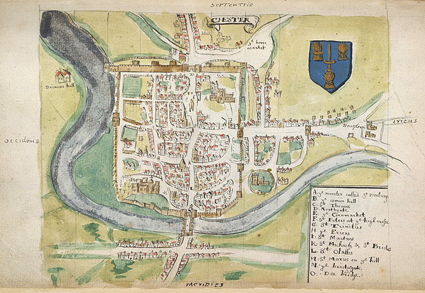
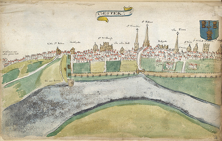
| This map of Chester, and the view of the city below, dating from the same time, are by the antiquarian and cartographer William Smith. He was a persuivant- an officer of the College of Heralds, an establishment that specialised in genealogical work for the rising class of nobles in Elizabethan times. In 1588 Smith published The Particuler Description of England With The Portratures of Certaine the Chieffest Citties and Townes. These two images may have been rough preparatory drawings for this work. A few years later, in 1602-3, Smith produced a further series of maps of English cities, including one of Chester, as part of a plan to publish an atlas. Unfortunately for Smith, another cartographer, John Speed, was preparing superior maps at the same time and the competition proved too great for Smith. (Speed's map of Chester may be seen on the next page.) (Descriptions of the images to follow) |
On to John Speed's Map of Chester 1610
Site
Front
Door
|
Chester
Walls
Stroll
Introduction
|
Old
Maps
&
Aerial
Photographs
|
Site
Index