|
|
|
|
|
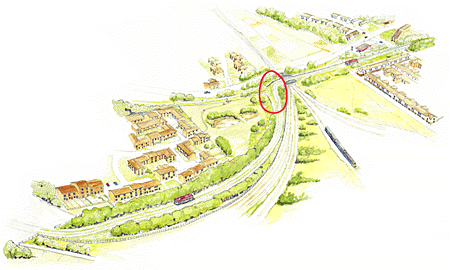
 Photographs
and
'artist's
impressions'-
such
as
this-
in
the
official
consultation
leaflets
issued
by
the
City
and
County
councils
show
the
busway
leaving
the
railway
at
a
sharp
right
angle
to
the
track
(circled
in
red),
clearly
avoiding
the
ponds. Photographs
and
'artist's
impressions'-
such
as
this-
in
the
official
consultation
leaflets
issued
by
the
City
and
County
councils
show
the
busway
leaving
the
railway
at
a
sharp
right
angle
to
the
track
(circled
in
red),
clearly
avoiding
the
ponds.Upon being quizzed about the unlikelihood of buses being able to negotiate such a sharp bend, City Engineer Colin Stredder, in obvious contradiction to the 'official' material, admitted to the possibility of these ponds having to be filled in to accomodate the great earthwork carrying the busway. In addition, a bus driver acquaintance assures us that his vehicle would be incapable of safely negotiating the curve as it is shown in the illustration. Sure enough, the Chester Chronicle of 7th May 1999 carried the following city council notice: DISPOSAL
OF
LAND
FORMING
PART
OF
AN
OPEN
SPACE. Notice is hereby given that the Council of the City of Chester intend after
the expiry of the period mentioned below to dispose of three areas of land
forming part of an open space, namely land adjacent to Brook Lane Bridge,
off Northgate Avenue and Victoria Road, Chester measuring 2210 and 2360
sqare metres respectively. (we make that only two pieces...) Thus the illustrations in the official consultation material would indeed appear
to have been misleading and inaccurate. |
|
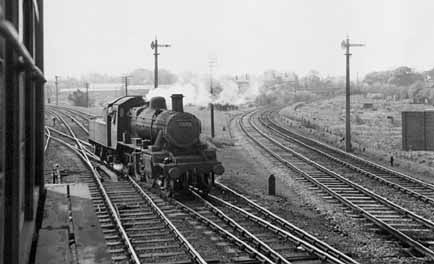
This fascinating photograph from May 1959 shows how much this part of the old railway has changed. A signal box- the Chester East Box- once stood here (seen on left of photo). |
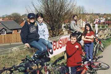
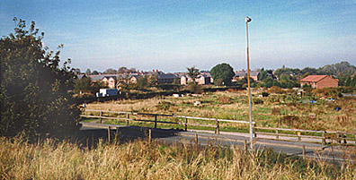 Here, west of Newton Lane, the line runs close to,
and parallel with, busy Brook Lane. Bicycle and foot access between
the cycletrack and Brook Lane has been provided via a ramp at this point.
Here, west of Newton Lane, the line runs close to,
and parallel with, busy Brook Lane. Bicycle and foot access between
the cycletrack and Brook Lane has been provided via a ramp at this point.