Chester: a Virtual Stroll Around the Walls
Old
Maps and Aerial Photographs of Chester
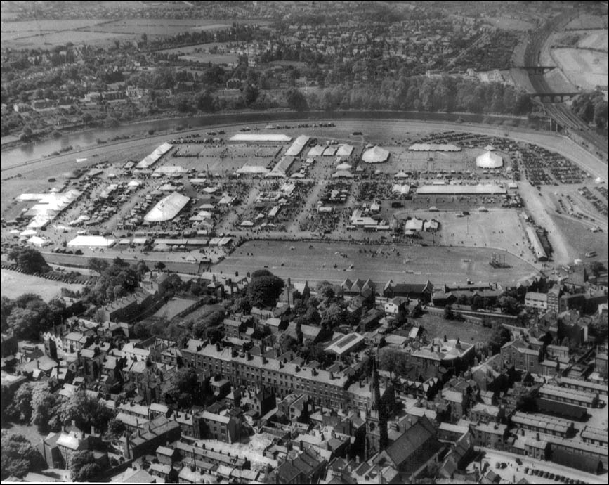
Chester from the Air: The Roodee, date unknown
|
Here is a splendid aerial photograph of Chester's venerable racecourse and showground, the Roodee. A major event is taking place, perhaps an agricultural fair, and the entire vast area is covered with marquees and hordes of people. The date is unknown but a number of motor vehicles are parked in the top right corner of the field- seemingly considerably less than would be present for a similarly large event today! The tall spire of Holy Trinity Church is seen in the foreground and just beyond it runs the line of Nicolas Street, evidently not yet widened to form part of the 1960s Inner Ring Road. The line of Watergate Street crosses it to join the line of the City Walls just before the Roodee. The large green area here, on the corner of Watergate Street and Nun's Road, is a curiousty to modern eyes, having long since been built upon. The same applies to the open area on the extreme left hand side of the photograph. Just below this, the tower of St. Martin's Church can be seen. One of the ancient parish churches of Chester, it was obliterated without trace when the Inner Ring Road was built and few would now suspect that a church that had stood here since Saxon times had ever existed at all. Ironically, its parish is remembered in the name of the stretch of modern unban road that runs past its ite- St. Martin's Way. A utilitarian car park stands near its site today. Visit our Roodee chapters to learn more about the fascinating history of this area...
|
On to a fine old watercolour of Chester from the air..
Site
Front
Door
|
Chester
Walls
Stroll
Introduction
|
Old
Maps & Aerial
Photographs
|
Site
Index