Chester: a Virtual Stroll Around the Walls
Old Maps and Aerial Photographs of Chester
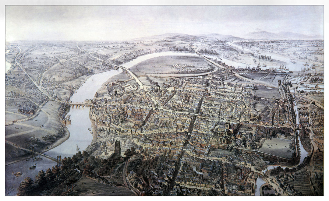
John McGahey: View of Chester From a Balloon 1855
Here are a series of enlarged details and descriptions from the wonderful image above:
|
|
|
|
|
|
|
|
More details to follow! We're grateful to Chester History and Heritage for their valued assistance in preparing this feature.
In 1853, John McGahey illustrated and published a splendid map of Chester, which you can see on this external link:
McGahey's New Chester Guide (We'd dearly love our own copy of this!)
On to a handy modern sketch map showing the main features of medieval Chester
A fascinating research project: Mapping Medieval Chester
Site
Front
Door
|
Chester
Walls
Stroll
Introduction
|
Old
Maps
&
Aerial
Photographs
|
Site
Index