Chester: a Virtual Stroll Around the Walls
Details
from
John
McGahey's
View
of
Chester
from
a
Balloon
1855:
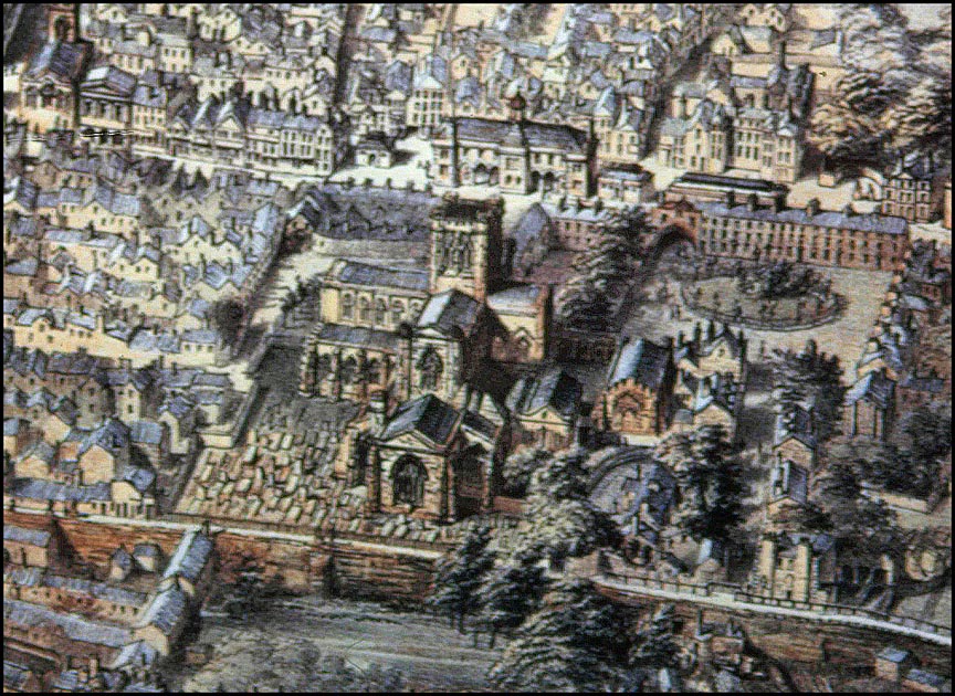
5.
The
Cathedral
|
When
John
McGahey
floated
in the basket of his balloon above
Chester
in
1855,
he
captured
this
unique
view
of
the
medieval
cathedral
as
it
appeared
before
being
subject
to
a
series
of
radical
and-
mostly-
necessary
restorations. Out of sight in the trees at the bottom is the smallest of the gates in Chester's City Walls, the Kaleyard Gate, built here by permission of King Edward I in 1275 to allow the monks easier access to their gardens- on condition that was built small enough to prevent armed men on horseback from riding through it and that it would be kept securely locked at night and in times of war. The tradition of locking the gate at nine o'clock each night continued right through until just a few years ago. The Kaleyards
is
today
used
as
a
car
park although, at the time of this update, Summer 2011, there exists a ludicrous and much-criticised council plot to relocate Chester's Market Hall onto it.... Other enlarged sections from McGahey's wonderful illustration:
|
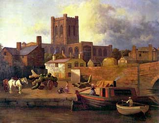 Author
and
traveller
Daniel
Defoe had
written
of
it
a
century
earlier,
"
'tis
built
of
a
red,
sandy,
ill-looking
stone,
which
takes
much
from
the
beauty
of
it,
and
which
yielding
to
the
weather,
seems
to
crumble,
and
suffer
by
time,
which
much
defaces
the
building".
Author
and
traveller
Daniel
Defoe had
written
of
it
a
century
earlier,
"
'tis
built
of
a
red,
sandy,
ill-looking
stone,
which
takes
much
from
the
beauty
of
it,
and
which
yielding
to
the
weather,
seems
to
crumble,
and
suffer
by
time,
which
much
defaces
the
building". 
Site Front Door | Chester Walls Stroll Introduction | Old Maps index | View from a Balloon | Site Index